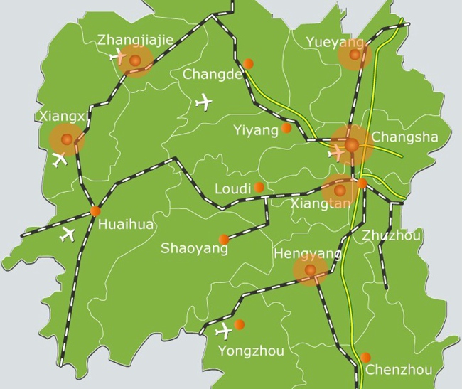
-
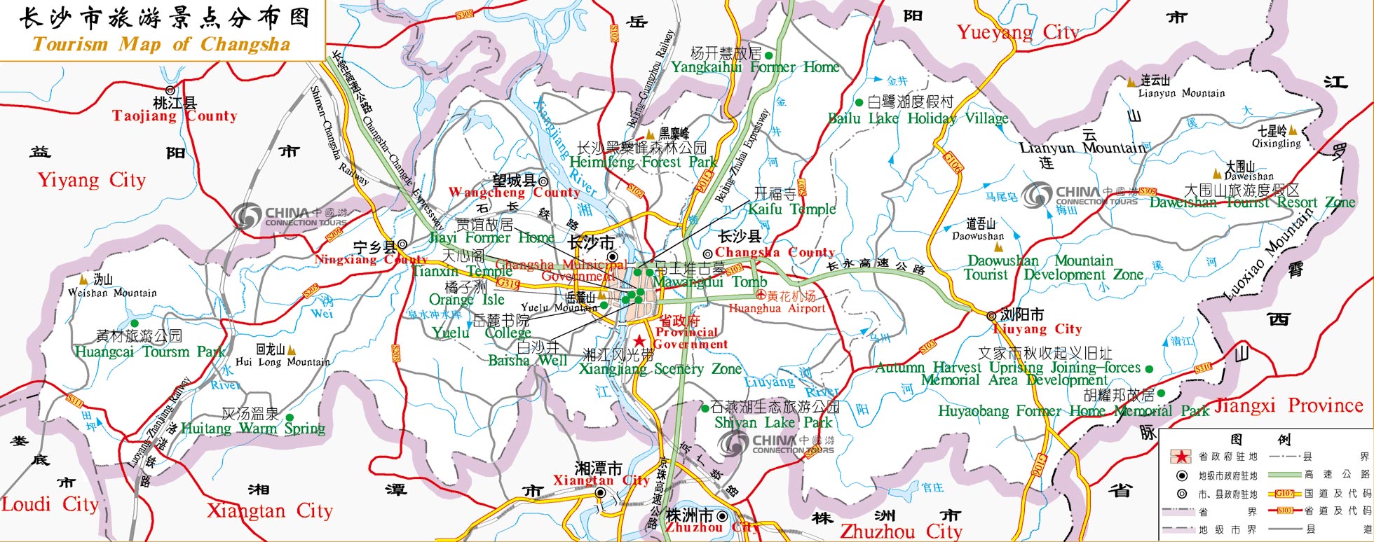
Changsha City is Situated in the river valley along the lower reaches of the Xiang River, Changsha is the capital city of Hunan Province. The recorded history of Changsha can be traced back 3,000 years. Tomb relics from the primitive periods witnessing the earliest human activities have been discovered in this region.
2012-02-02 12:59
View:7805
-
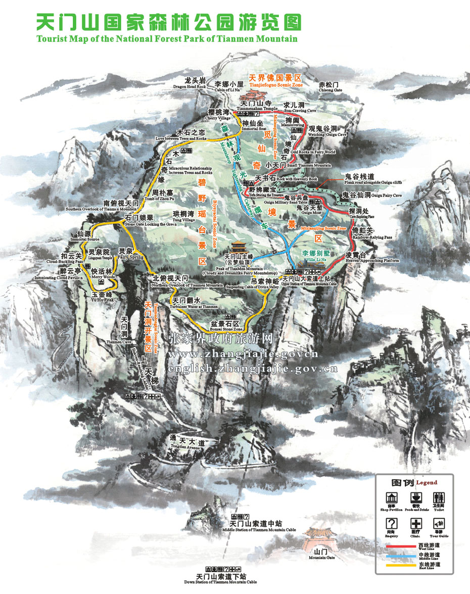
Tianmenshan Mountain is the second national forest park in Zhangjiajie. On the mountaintop are intact sub-primitive forests with overflowing wild atmosphere in all the seasons. In addition, the densely populated karst hillocks and karrens plus the mating of strange rocks and graceful trees. create a grand garden of bonsai as if blessed by the God.
2011-10-18 12:05
View:12638
-
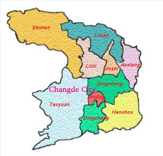
Changde is located in the northwest of Hunan, with the Dongting Lake on its east, and bordering on Hubei province on the north, Hunan Xiangxi Autonomous Prefecture on the west and Yiyang city on the south.
2010-03-18 19:07
View:5295
-
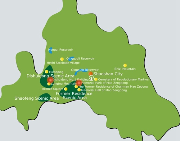
Shaoshan, one of the four major revolutionary memorial lands of China, has been well known in the world because of Mao Zedong, a great leader of China. With fascinating scenery, Shaoshan Scenic and Historic Interest Area is mainly composed of Former Residence of Mao Zedong, Shaofeng Peak, Dishui Cave, Qingxi and Heishizhai scenic areas.
2010-09-09 00:57
View:7153
-
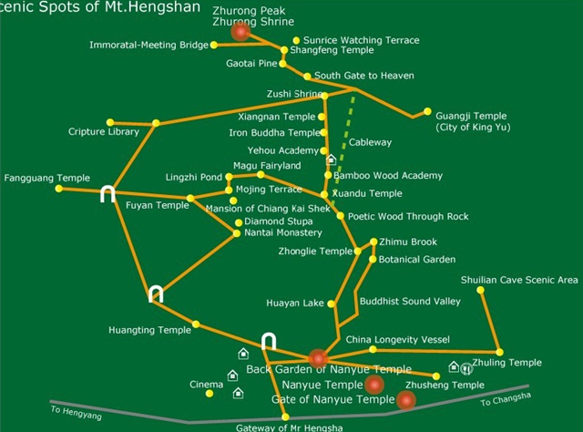
Mountain Hengshan, The Great Mountain of the South, is known as one of the five great mountains in China. Located in Hengyang City, Hunan Province, the mountain has 72 peaks, stretching 400 km, along with, grand and magnificent temples.
2010-11-16 00:55
View:7932
-
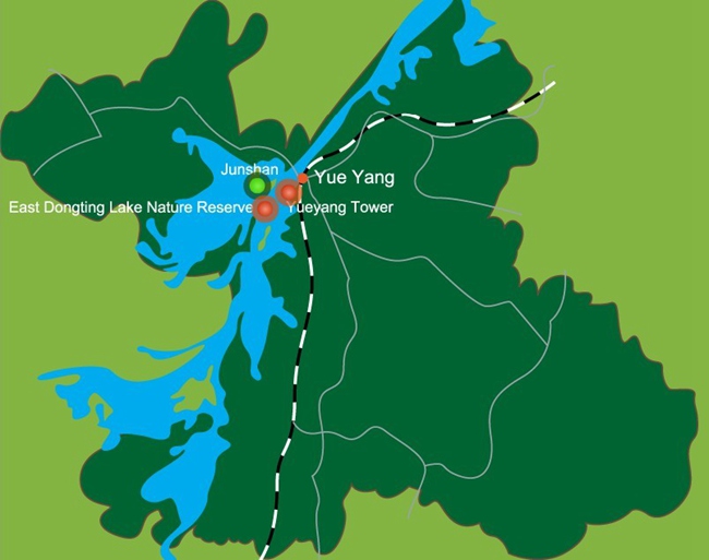
Yueyang is situated in the northeast of Hunan Province, Yueyang has been famous in China for the picturesque Dongting Lake and gorgeous Yueyang Tower since ancient times.
2010-12-22 00:50
View:6380
-

Zhangjiajie is one of famous cities for the unique mountains and green scenery. There is a saying that the mountains in Zhangjiajie will have different looks if you come to visit it in different seasons, which attracts thousands backpackers come to explore the city annually. Guests can hold the local map and enjoy the beautiful scenery there on their own.
HOT
2021-06-09 16:25
View:9882
-
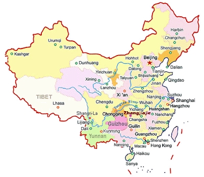
Zhangjiajie is a newly developed international tourist city, which lies on the border of Hunan Province. It is rich in water resources despite of being not a coastal city. The region covers an area of 91,563 square kilometers and has a large population of 1.68 million, 60% of whom belong to the Tujia, Bai and Miao minorities.
2014-12-19 16:23
View:17020
-

Zhangjiajie is a newly developed international tourist city, which lies on the border of Hunan Province. It is rich in water resources despite of being not a coastal city. The region covers an area of 91,563 square kilometers and has a large population of 1.5 million.
HOT
2016-10-29 16:20
View:9046
-

Fenghuang is located in the west of Hunan province, Fenghuang consists of 9 towns, 22 counties and 344 administrative villages. The old city wall was first built around 1704 with east and north gates still erected. The peaceful Tui River flows across the small town, you can see quite a number of wooden cabins were built half suspended over the river, people usually call them ‘Diaojiaolou’.
2010-11-24 14:14
View:14360
